Soundscapes, sonifications and compositions by staff & students at UWE and CCRI
An introduction to the Severn Estuary
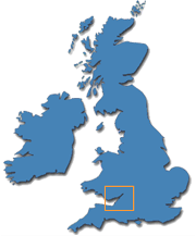
The Severn estuary forms the sea division between South West England and South East Wales and the coastal edge of 11 local authority areas: Devon; Somerset; North Somerset; Bristol; South Gloucestershire; Gloucestershire; Forest of Dean; Monmouthshire; Newport; Cardiff and the Vale of Glamorgan.
The estuary is 557 km2 with around 18% of this being intertidal (100 km2). It has the highest tidal range in Europe and the second highest in the world. The tides and intertidal areas are a fundamental and unifying feature of this area's character. They are extraordinary visual spectacles in themselves and the intertidal areas and margins are home to a rich combination of internationally important natural and culture heritage.
Approximately 80% of the estuary's 370 km shoreline is lined with sea walls (regular, grassed earth banks in rural locations; concrete walls in ports and towns). These stop the very highest tides flooding low lying surrounding land. The sea walls are, in many places, open access and used for recreational purposes, and accessing/viewing the intertidal areas.
Some 3 million people live around the estuary in large urban conurbations (Cardiff, Newport, Gloucester, Bristol); smaller towns (Weston, Cleveland, Chepstow), and remote rural settlements, set in open, rich, agricultural land. Other comparable coastal areas in the world are in remote rural landscapes, so the Severn Estuary is the most tidally dynamic estuary in the world that is also close to large population centres.
Created by the relational movement of earth, sun and moon, the semi-diurnal tides in the estuary (rising and falling roughly twice every 24 hours) have complex daily, monthly and seasonal rhythms. At the very highest tides (perigee spring tides) which occur at the equinoxes, the sea level can rise and fall by as much as 14.5 metres in the space of 12 hours. That is the sea level rising three times the height of a double-decker bus in six hours then receding again.
The high tides wash up the estuary to create the famous Severn Bore, a tidal wave that runs over 7 miles up the Severn River above Gloucester, which attracts many tourists, surfers and artists.
Environmental pressures
Intertidal areas are often taken-for-granted by the public and even planning authorities in the UK and beyond. They can be regarded as 'empty' and even ugly, and thus are at risk of neglect, abuse and/or development, even if they are under nature conservation designation.
It has been argued that many of the 3 million people who live around the estuary (especially those in large conurbations) have 'lost touch' with the tidal/estuarine landscape. This leaves those who do access the estuary shoreline and intertidal areas as a passionate minority.
Many of the traditional practices and the crafts associated with them, such as boat building and repairing, ferrying and navigation, and those associated with the local forms of fishing/agriculture have declined.
Concrete risks to the landscape include; coastal development (for housing, transport, industry and power generation); pressure on natural systems (e.g. pollution / water quality), aquatic biodiversity decline (e.g. salmon and eels); resource extraction (e.g. dredging of building aggregates) and perhaps most significantly, major tidal power generation schemes and the potential impact of climate change through sea level rise.
A sustainable future
Reconnecting local communities to landscapes and geomorphological processes is an in important aspect of developing resilience and sustainable management. Under the UK Flood and Water Management Act 2010, local authorities responsible for managing the risk of local floods. This points to demands now being placed on local authorities. One important step in meeting those demands is to develop better understandings of local water issues with communities in order to support effective decision making and behaviour change.
© 2012 Owain Jones
Map and introduction
to the Severn Estuary